Kauring Project
The Kauring Project is comprised of six granted ELs (E70/4508, E70/5276, E70/5277, E70/5758, E70/5759 and E70/3536 (Jubuk)) with a combined area of approximately 75 km2, centred approximately 7 km northeast of Kauring, a small farming locality 28 km east-southeast of York.
Target Commodities
- Ni-Cu-PGE hosted in mafic / ultra-mafic intrusive rocks.
Project History;
- Historical exploration focused on iron ore, industrial minerals/base metals;
- Consolidated Copper Pty Ltd (2006) defined a Au-Cu-Pb-Zn anomaly in RAB drilling (Piggott, 2007);
Project Geology#
| Age | Archean 4 Ga – 2.5 Ga |
| Terrane | Youanmi Terrane |
| GSWA Lithology | metamorphosed mafic rocks; granitic rocks; siliclastic rocks; iron formation; granodiorite and ultramafic rocks |
# Source: Geological Survey of Western Australia, Youanmi Terrane (YYO) explanatory notes
Exploration Analysis
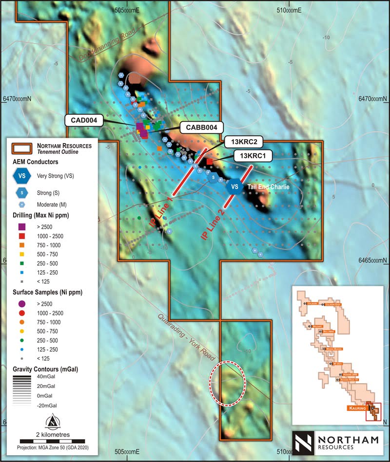
- Discordant “blobby” magnetic may indicate mafic-ultramafic intrusive rocks;
- 28 very strong, strong, and moderate conductors identified in an Airborne Electromagnetic survey conducted by NRL (2022);
- An Induce Polarisation survey by NRL showed a strong conductivity anomaly across both lines;
- Large coincident gravity anomaly.